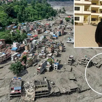
On the morning of 26 August 2026, a wall of ice, rock, mud and water tore down a Himalayan valley on the Nepal–China border faster than most vehicles travel on a highway. Within minutes it had destroyed the Gyirong (Kyirong) port complex, Nepal’s main trade and pilgrimage gateway to Tibet, and was surging south through Rasuwa, Nuwakot, Dhading and beyond. By the time it slowed, more than 700 people were dead in Nepal, thousands were missing, and floodwaters had carried bodies as far as India, 240 kilometres away, according to reports compiled from Nepali and international sources. The precipitating event — an ice-rock avalanche near Langtang Lirung that triggered a seismic tremor of magnitude 5.2 — began at roughly 5,200 metres elevation, far above any village, any road, and, crucially, any sensor.
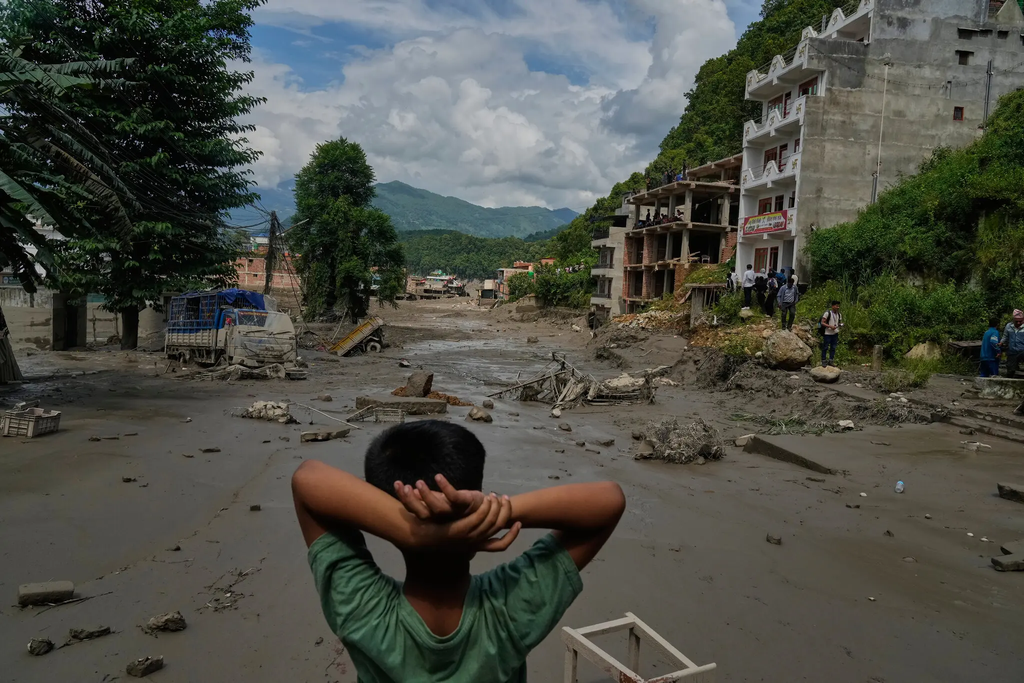
That last fact is the real subject of this article. Nepal’s tragedy was not simply a flood. It was a cascade — glacier collapse, landslide, river damming, and flash flood compressed into less than half an hour — and it raises a question that reaches far beyond the Himalayas: are the world’s disaster-preparedness systems built for hazards that develop faster than they can be detected?
What happened in the mountains
Satellite imagery reviewed after the disaster shows a large mass of glacier ice, entangled with rock and debris, detaching high on the slopes above the Lhende Khola and dropping roughly 1,200 vertical metres. Nepal’s Department of Hydrology and Meteorology found no evidence of the intense local rainfall that typically precedes Himalayan flash floods, pointing instead to a mass-movement origin. Nepal’s disaster authority described it as a “glacier-inclusive flood” caused by an ice-rock avalanche on the Nepali side of the border. The debris and meltwater temporarily dammed the Lhende River before bursting through, sending a wave that scientists estimate travelled the first 22 kilometres at an average speed of around 193 kilometres an hour — nearly 14 miles in under seven minutes. The surge fed into the Bhote Koshi and then the Trishuli River, where water levels reportedly rose nine metres in half an hour, before continuing 72 kilometres downstream through Rasuwa, Nuwakot, Dhading, Gorkha, Tanahun, Nawalparasi and Chitwan districts.
The toll has climbed steadily as search operations continue: over 700 confirmed deaths and roughly 2,500 people still missing in Nepal, with additional casualties in Tibet. Roads, bridges, hydropower infrastructure and the Gyirong border crossing were devastated. Rescue teams have faced continued danger from unstable slopes and the risk of secondary flooding, since the event left behind altered drainage patterns and potentially unstable debris dams upstream.
A disaster larger than a “flood”
It is tempting, and simpler, to call this a glacial lake outburst flood — the hazard most associated with Himalayan glaciers in the public imagination. Scientists caution that this framing does not fully fit. Unlike Nepal’s 2025 Rasuwagadhi disaster, which the Stimson Center traced to drainage of a supraglacial lake, current evidence for the August 2026 event points to an ice-rock avalanche that dammed a river and then failed, rather than a pre-existing lake bursting. Researchers writing in Earth System Science Data describe this broader category — gravity-driven failures of glacier ice on steep terrain, including ice avalanches, glacier detachments and rock-ice avalanches — as mechanically distinct from, though related to, classic outburst floods. The distinction matters: a hazard map built to track known glacial lakes will not necessarily flag a slope where no lake exists at all.
Why early warning struggled
This is the disaster’s hardest lesson. The source zone sat at extreme altitude, in terrain too remote and inaccessible for ground-based sensors, and not identified by conventional glacial-lake risk inventories as an imminent threat. The collapse-to-impact sequence unfolded in minutes, not hours — a timeframe in which even a functioning alert would struggle to reach and mobilise downstream communities. Reporting by the New York Times found that the sheer speed of the flood likely overwhelmed the very early-warning infrastructure Nepal and China had built together after the 2025 Rasuwagadhi flood. This does not mean authorities failed in any simple sense; it means the hazard exceeded what current monitoring, however improved, was designed to catch. The appropriate lesson is not “the system failed,” but “the system was built for a narrower category of hazard than the one that occurred.”
Nepal’s warning to the world
Nepal is not an isolated case. In 2021, a rock-ice avalanche in Chamoli, Uttarakhand, killed more than 200 people and destroyed hydropower infrastructure along the Rishiganga and Dhauliganga rivers. That same year, a glacial lake outburst above Melamchi, Nepal, buried towns downstream. In 2023, the South Lhonak glacial lake outburst flood in Sikkim swept away a major dam and killed dozens. In 2025, a collapsing glacier above Blatten, Switzerland, buried most of the village beneath rock and ice. Each event had its own trigger and geology; none should be flattened into an identical story. But together they describe a pattern: high-mountain hazards involving ice, rock, water and infrastructure are increasingly interacting in ways that conventional single-hazard categories — flood, landslide, avalanche — do not fully capture. As ICIMOD researchers and Himalayan geographers writing in New Spotlight Magazine have noted, these are becoming recognisable as compounding cryosphere risks rather than freak accidents.
From response to prevention
A credible global agenda has to move on several fronts at once, because no single tool is sufficient on its own.
Monitoring needs to combine satellite imagery, seismic networks, ground sensors, hydrological gauges and glacier observation, layered with data analysis capable of flagging anomalies across a wide, remote terrain — not relying on any one instrument to catch every failure mode.
Warning systems are only as good as the last mile. Sirens, mobile alerts, community radio, marked evacuation routes, regular drills and multilingual communication determine whether a detected hazard actually saves lives, particularly when reaction time is measured in minutes.
Risk mapping must expand beyond known glacial lakes to include unstable slopes, permafrost degradation, potential river-blocking debris, and the downstream exposure of roads, bridges, hydropower plants and settlements — mapping consequences, not just known hazard sources.
Cross-border cooperation is not optional in a basin like the Trishuli, which begins in Chinese territory and flows through Nepal. Nepal and China had already agreed to cooperate on glacial lake monitoring after the 2025 disaster; the 2026 event shows that agreement needs to extend to real-time seismic, satellite and hydrological data-sharing, not just glacial-lake inventories — a point pressed by New Spotlight Magazine’s call for a formal “Nepal–China Himalayan Hazard Data Protocol”, without attributing blame in the absence of independent evidence.
Climate adaptation policy must treat prevention, monitoring, resilient infrastructure siting and, where necessary, relocation as part of the same portfolio as post-disaster reconstruction — not a separate, lower-priority track.
International institutions — the WMO, UN agencies, ICIMOD, satellite operators and development banks — can extend the technical and financial capacity that individual mountain states cannot build alone, particularly for remote, high-altitude monitoring that pays no economic dividend until the day it prevents a catastrophe.
The global question
None of this is unique to the Himalayas. The Andes, the Alps, Alaska and the high mountains of Central Asia face comparable dynamics: warming temperatures, retreating glaciers, degrading permafrost and increasingly unstable slopes. Scientists are careful not to claim that climate change caused this specific collapse — establishing direct causation for a single event takes time and evidence. What researchers do say, including scientists cited by Nature, is that warming is altering the physical conditions of high-altitude terrain in ways that plausibly increase the likelihood of such failures. That distinction — between causing an event and reshaping the odds — is the one policymakers most need to internalise.
Conclusion: designing for uncertainty
The real lesson from Nepal is not that every glacier can be predicted before it collapses. It is that disaster preparedness must be designed for uncertainty. Governments do not need a perfect forecast for every mountain slope; they need systems capable of detecting cascading hazards as they begin, communicating risk and uncertainty quickly, coordinating across borders in real time, and protecting communities even when scientists cannot say precisely when or where the next collapse will occur. Nepal’s flood happened faster than any warning system built to date could plausibly outrun. The task now is not to promise the impossible, but to close the gap between the speed of these disasters and the speed of the response they demand.
Sources
- Al Jazeera, “Nepal-Tibet floods: What is a glacial collapse, how common is it?” (27 Aug 2026)
- Al Jazeera, “Nepal-Tibet floods: What happened, what caused them and who is missing?” (27 Aug 2026)
- CNN, “Deadly flash flood hits Nepal-China border region” (26–27 Aug 2026)
- Nature, “Glacier collapse caused Nepal’s deadly flash flood — a sign of things to come?”
- Geology Page, “Nepal Flash Flood, August 2026: Ice-Rock Avalanche, River Damming, and Cascading Himalayan Hazards”
- ICIMOD, “Kyirong-Rasuwa Flood 2026 — Nepal-China Cryosphere Risk”
- World Meteorological Organization, “Flood tragedy in Nepal highlights cross-border and cascading risks”
- Stimson Center, “A Cascading Disaster on the China–Nepal Border: What to Know About the August 2026 Rasuwa Flood, 72 Hours Later” and “Climate Risks to Nepal’s Energy Transition”
- New Spotlight Magazine, “Rasuwagadhi’s Warning to Nepal: From Himalayan Catastrophe to a National Doctrine of Anticipatory Resilience”